Sunday, September 28, 2014

Examples of zoning screwing up TOD

I spoke about how TOD needs to be privileged over building new lines, and how real TOD ought to be, pointing out Chigasaki station. Well, now let me rant about how North American planning practices can seriously screw over attempts to build rational cities centered around transit.

May I present to you: Radisson Station?

Radisson Station is a station near the eastern end of the Green Line of the Montréal Metro. It is a direct 20-minute ride away from downtown Montréal,
Radisson in the Montréal Metro map
The station is close to a freeway, Autoroute 25, has a mall right next to it, but only a small section of the mall is near the station, the biggest part is farther away, and the station itself is mainly surrounded by plenty of parking, its location near a freeway means it is a big park-and-ride spot.

It actually has two entry points, one north and one south of a major arterial street. Here is what they look like:

Northern entry point

Southern entry point
Already, there is a massive TOD mistake, in fact two of them:

First, these buildings that are entry points of the subway system serve no other purpose. We're talking of the location that is the easiest to access from a subway, the location right on top of it, and the STM (the transit operator) is content to have two small buildings that serve absolutely no other purpose. To be fair, the southern entry point has an excuse, it is under high-tension power lines that limit what could be built, but the northern entry point has no such excuse. Neither do the dozens of similar entry buildings the STM has all over Montréal. The easiest idea ever would be for the STM to ask for bids from promoters to build high-density residential, commercial or office buildings to replace their mostly useless entry buildings. I think it could get plenty of cash that way.

Second, most of the land immediately adjacent to the two entry points is actually parking lots or a small bus terminal.
The two entry points in green, parking lots in red, the small bus terminal in orange
 The result is that, apart from a few houses to the north-west, the nearest residential areas are at least 300 meters (1000 feet) away from the station, separated by plenty of parking and an uncomfortable walking environment. They really ought to build something instead in the area, and if they want to maintain the park-and-ride, they should at the very least make it a multi-storied parking garage to free up the rest of the area for development, or to shove the parking underground, under buildings.

But what I mainly want to bring attention to is something symptomatic of North American zoning practices, which this area illustrates to a T. First, a map of the north side of the neighborhood (forgive us Montrealers, our north is more west than north, we simply have the St-Lawrence river that we consider "south" even if it's actually more to the east).
North-west of the station, the station is the green dot
 On the previous image, there are 3 red dots with numbers in them, they are viewpoints I have captured from Google Maps to show what houses there look like, to see how housing evolves the further we get from the station.

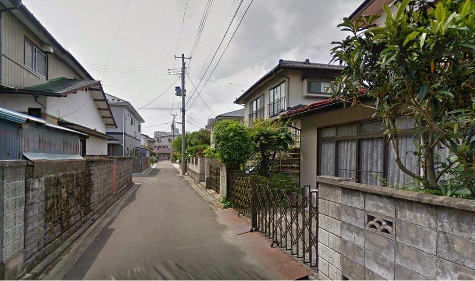
Point 1: single-family houses on large lots (15 units per hectare, 6 per acre)
Point 2: semi-detached houses and duplexes (35 units per hectare, 14 per acre)
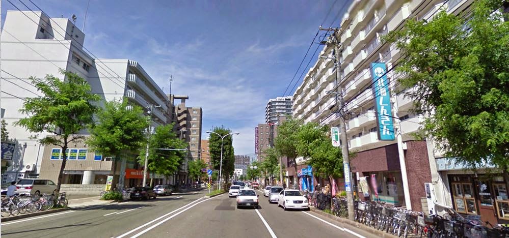
Point 3: condo towers in park(ing lots) (about 200 units per hectare, 80 per acre)
Did you notice the problem here? No, I didn't mess up the order of the images. Believe it or not, the residential density INCREASES the farther one gets from the subway station! The condo towers here are no less than 2 kilometers (1,3 mile) away from the station, a 10-minute bus drive away (plus waiting time). That is the exact opposite you should do, you want to reduce transfers in transit trips, not increase them, so you want the densest concentration of housing and jobs as close to subway stations as possible, but it's the opposite that happens here.

How it came about

There is a logic to the madness here. The single-family houses at point 1 were built in the 1950s, at the time, there was no subway and plenty of space available for development in the region. It was actually considered a relatively far suburb, in fact it was farther from the downtown area than the official suburb of Longueuil. So in that context, single-family houses do make some sense.

The duplexes seen at point 2 were built at about the same time as the subway station in the 1970s. At the time, such buildings (semi-detached and duplexes with parking in the basement and the living area built above) were all the rage in Montréal as they were able to get some density yet still have enough parking according to the paradigm of automobile-focused development. As Montréal had little land to develop and the border of suburbanization had long gone even farther, some higher density was warranted.

The condos seen at point 3 were largely built in the 1990s and the 2000s. Places left to develop in Montréal had grown exceptionally rare (in fact, this whole area is part of an ancient suburb called Anjou that was merged to Montréal in the late 1990s). So the land was very expensive, and the suburban growth now extended to areas twice as far as this. The idea of building higher densities had now become more popular.

So if you look at the chronology, every "layer" of residential density actually made perfect sense when they were built.

The issue then becomes: why are we keeping these areas as-is when the context has changed so much? If 15-story condo towers are justified 2 kilometers away from the subway station, why wouldn't they be justified 100 meters away?

Well, because of zoning of course. The area is zoned as sector 14-06:
map of zoning sectors for the Mercier borough
And this sector is identified among a lists of sectors where the zoning is built to "preserve the area's 'character'". It is even written explicitly in the borough's official urbanism plan.
Here is the original in French
This is the English translation I made
Now, this is a plan, not the gritty details. What does average building-to-lot ratio mean? The plan doesn't say, but I bet there is a document somewhere that does.

Still, as the zoning stands, it ought to be possible to slightly densify the area, but you would need to buy and destroy the existing building which has value as a house, around 400 000 to 500 000$ in the area. So that means that if you allow density to double at most, the houses that will be built will have to absorb an additional 200 000$ to 250 000$ in construction cost, likely making them too expensive, unless they are luxury housing.

This is where an approach that allows for much higher density and piecemeal replacement would work much, much  better.

Other examples: recent condos in Québec

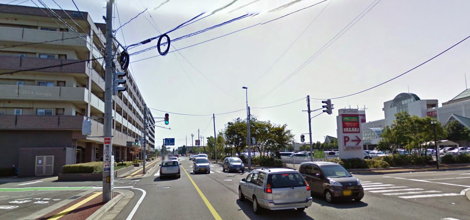
In Montréal, all cities of the metropolitan area accepted a plan to supposedly create a sustainable metropolitan area, to increase density and concentrate development in TOD areas. This sounds good, but in practice, in many, many cases, what this resulted in is municipalities deciding to allow low-rise condo buildings on the outskirts

We always used to have a few condos and apartment blocs near commercial areas in our suburbs, but with this plan now in place, we have seen something happen which was rare before. In order to satisfy density goals, cities started requiring higher density developments from developers who develop on the outskirts of existing cities. The result was pretty poor: condos with 40 to 60 units per hectare (16 to 24 units per acre) built on the edge of field, or near highways, where there was nothing in close proximity. In order to save on costs and since land is cheap, these residential-only developments are generally surrounded by big parking lots.

You can see this in real estate listings on centris.ca, which shows the WalkScore of each listing. The WalkScore is a way to account for "walkability" depending on proximity to services and businesses. The score goes from 0 to 100. From 0 to 49, locations are car-dependent, from 50-69 they are considered somewhat walkable, from 70 to 89, they are very walkable, and  from 90 to 100, they are considered walkers' paradise. All the following listings are thus considered to be in car-dependent locations.


Most suburbs do have locations that have 70-80 WalkScore, so it's not like all the suburbs are car-dependent deserts.

There are still some legit TOD going on, condos being built in areas with 70+ WalkScore, but the amount of car-dependent condos is very high. The one advantage I can see is that these mostly 1000+-square-foot condos are pretty affordable, ranging from 180 000 to 250 000$, allowing the new generation to have affordable housing without going too far into the exurbs. Indeed, most people I know of my own age who have bought a home have bought, at least initially, a condo like these ones. Some have gone on to houses, others are still in condos. It's also an interesting tale of what happens when developers have to try to build density with at least 2 parking spots per unit because of suburban parking requirements and because that's what their clients will need (they are in car-dependent areas after all). And all that while trying to avoid underground parking since it's too expensive to build while land is cheap. Note that alleyways in back are very rare in Québec.
Parking lots behind condo buildings, a classic solution sacrificing the back yard

...and the denser and taller the buildings, the bigger the parking lots
A long driveway to a garage, probably to satisfy two requirements: 1- places for 2 parking spot, 2- the driveway can't occupy more than 40% of the front of the lot. Note how one owner created a fork in his driveway to be able to park 2 cars without one blocking the other and still respect the rules
A rare case of parking lot in front, sacrificing the front yard but preserving the back yard. Results in houses facing the parking lot instead of the street
This is almost Japanese in design... driveways in front for condos, with the driveways being long enough for two small cars. It looks bad from the front, but it is an extremely space-efficient way to cram parking spots for a multi-family home
Massive parking lots AND parking garages under building.... that's what you get when you try to build 6-story condo buildings in a car-dependent area where you need 2 parking spots per unit

Again, this is due to the zoning which makes it near impossible to densify places that are currently walkable in most instances, as they're often currently occupied by low-density housing which are about the only thing that can be built in the area. Many old houses exist that are quite cheap but on big lots in the walkable areas of suburbs, which would be ripe for replacement. Here are some images that I got from searches on centris.ca for single-family houses for less than 300 000$ in areas where the WalkScore is between 60 and 85:
There are plenty of old single-family houses ripe for teardown, which could be replaced piecemeal by townhouses, triplexes or even 6-condo building with some imagination (and a reduction of parking requirements to one per unit). For instance, most single-family homes in Longueuil tend to have a lot that is 20-meter wide (66 feet) and 30-meter deep (100 feet). Well, these buildings also are built on lots of those exact same dimensions:
...they just have 6 times as many units, and each of these units is at least 100 square meters big, or around 1 100 square feet.

Conclusion

These are just demonstrations of how the mentality of urban development that dominates in North America that "once an area is built, it should remain that way" is deleterious to actually having rational, efficient cities. Building dense areas on the outskirts of metropolitan regions is not an answer, these areas are generally transit-poor and unwalkable, which results in denser areas which need as much parking space as regular car-dependent suburbs, but the density means that parking lots dominate and make for a very poor looking area that is unlikely to draw people in or keep them there (except through low prices). Essentially, you have streets, parking lots and buildings, and not much else.

This is also why zoning has to be reformed. Zoning needs to allow higher densities and piecemeal densification in order to allow cities to evolve and to respond to higher demand for desirable areas.

Tuesday, September 23, 2014

Transit and congestion part 2: how congestion can cripple transit

In the previous article, I said that transit isn't really a solution to congestion, but a way to increase the capacity of congested roads and avoid congestion from choking the life out of urban areas. Basically, I spoke of the effect of transit on congestion, but it is very important not to underestimate the effect of congestion on transit viability.

Indeed, speed is vital for transit. Not only relative speed to other modes of travel as speed is probably the greatest factor to determine what mode of travel people will opt for, but also absolute speed, and for a simple reason: the cost of transit is directly impacted by the speed at which they travel. That is because a major part of the cost of transit is the driver, and he is paid by the hour. Furthermore, the slower each vehicle goes, the more vehicles you need to buy to be able offer the same capacity.

I know it is evident for most people who read this, but let me explain in detail through an example.

Let's take a given bus route:
  • It is 10-kilometer long (a bit over 6 miles)
  • It is a round-trip
  • To satisfy demand, you need to have a frequency of 4 buses per hour (capacity for a transit line = frequency of the vehicles times the capacity of each vehicle)
  • You can expect an average speed of 15 km/h (around 10 mph)
  • You have 400 riders who will take the bus
  • We will neglect the issue of layover for clarity, buses that end the route can start again just as fast as they arrive
Let's simulate this for 3 hours of the peak period.

Each line represents a bus going from the start of the route (0) to the end (10)
 In this case, at the most, you have three buses running on the route, so you need to buy 3 buses, each costing 400 000$, for an initial capital cost of 1 200 000$. During the three hours, buses are running in total for 7,25 hours. If each bus costs you 150$ per hour of running time to run, then that is about 1 100$.

So, to sum up, to provide this level of service and this capacity you need:
  • 3 buses, so initial capital cost of 1 200 000$
  • 7,25 vehicle-hours of running time, so 1 100$ operating cost
  • To pay back operating costs, each ticket must cost 2,75$
Now imagine that instead of an average speed of 15 km/h, you have an average speed of 12 km/h (7,5 mph), just 20% slower. What happens? Well, instead of taking 40 minutes to make the entire route, buses now need 50 minutes to do so.
The result? You need 4 buses instead of 3, as at the worst time, you will have 4 buses running the route at the same time, you will also require 8,85 vehicle-hours of running time for buses. In short:
  • The capital cost is now 33% higher, to 1 600 000$
  • The operating cost is 22% higher at 1 350$
  • To pay back operating costs, each ticket must cost 3,38$ if all 400 riders stick to the bus...
  • ...but if the slow speed convinces say 50 of them to stop taking the bus, the cost per remaining rider is 3,86$, 40% higher than previously
So just being 20% slower has just increased costs by around 25% and may increase ticket prices by even more than that if the slow speed gets people back into cars (and buses have to self-fund). The problem is evident: transit needs to be fast to be cost-effective, if transit is slow, then it is going to be unattractive and very expensive.

Overall, in this case, the cost of the transit service in relation to speed can be represented the following way:
Cost per passenger of transit service depending on whether we suppose ridership to be static (always 400 during peak hours) or dynamic (4% gain or loss per 1 km/h difference in average speed)
In practice, the effects of faster service are probably not as pronounced because of layover time between routes for bus drivers and the like, but the dynamic is still there.

Case study: streetcars

This is likely what happened to old streetcars. When they were introduced at first, roads were largely empty of vehicular traffic, with only pedestrians and a few horse-drawn vehicles around, generally keeping to the sides of the street or to the sidewalk. As traffic speed was about 5 km/h (3 mph), ie walking speed, there was no need for signalization at the vast majority of intersections. No traffic lights and no stop sign, some cops directing traffic at a few major intersections. So streetcars in that context almost only had to stop to allow passengers to get on or get off. Even if they couldn't quite go fast, their average speed was still pretty decent. Since labor was cheap, they even had another employee besides the driver, the conductor, whose job was to collect the fare from riders, so that passengers could pay the fare after boarding and thus avoid losing time dwelling at stops.

Some sources mention an average speed of 10 to 12 miles per hour (16 to 20 km/h) for streetcars in the US in the early 20th century (Source and source). Though it doesn't look that fast, take into account that the average speed of buses in New York City nowadays is 7,5 mph (12 km/h). In Montréal too, the average speed of buses in Montréal during the peak hours (when most people take transit) is about 12-13 km/h, around 7-8 mph. Despite nearly 100 years of technological advancement, transit is slower than back then.

Though data is scarce on the early 20th century (at least as far as I can find on the internet), most sources mention growing congestion as more and more cars came on the road. Traffic lights and stop signs started appearing in the 1910s and 1920s to deal with the higher vehicular traffic. These signalizations, though they ordered traffic, also had the effect (and still do) of causing delays on arterial roads. Even a well-programmed traffic light at a relatively little used intersection will frequently incur around 10-20 seconds of delay on average to cars passing through. So if you have one traffic light every 500 meters (around a third of a mile) on a 10-kilometer trip (6-mile), you will likely lose 3 to 6 minutes at traffic lights. So if you used to be able to do that length at an average speed of 20 km/h (12 mph), now you could have seen your speed actually fall down to 16-18 km/h (10-11 mph).

I imagine visually this is how traffic should have evolved:

Streetcars with mainly horse-drawn carriages and plenty of pedestrians (not shown), traffic is generally fluid due to few vehicles and low speeds of vehicles, allowing them to easily negotiate intersections

Cars become much more common, now there is friction at intersections and police directing traffic

Finally, we start adding signals to intersections

In old sources, often streetcars were blamed for congestion, due to the windshield perspective of those who used to have access to the media and the attention of the powerful. This is for a simple reason: most streetcars actually had tracks in the center of the street, in the left lane, the fast lane. How did passengers board? Well, at first, passengers waited in the street, forcing cars to slow down not to hit them. As traffic became more ordered, here is how it worked, and still works in Toronto:


Is it any wonder then that car drivers seethed at the sight of streetcars that blocked two lanes of cars when allowing passengers to board or alight? And why car drivers were so receptive to arguments for replacing streetcars by buses?


So, anyway, some posts back, I made a graph about the average speed of transit lines depending on how many stops they had to make and their maximum speed. I will re-use this to illustrate the effect of congestion on streetcar lines.

First, the original situation where streetcars largely had to stop only for passengers and faced little to no congestion to slow them down.
Initial situation, where streetcars only had to stop for passengers and faced no congestion
Now, after cars started congesting city streets and imposed traffic lights and stop signs, streetcars stop more often and go slower
Now combine this fact with the earlier fact about how slower transit is more expensive to run for the same capacity. This means that an operator in this situation has a choice of either reducing the capacity of transit lines by 30 to 40% or increasing the number of vehicles by 50% to maintain the same capacity. No matter what, it results in an increase of costs per passenger of at least 50%.

More importantly, this thought experiment reveals that streetcars, far from causing congestion, were actually a VICTIM of the congestion caused by cars. Car congestion increased transit operating costs and lowered their average speed, making them more expensive and less attractive at the same time.

Streetcar companies, that used to be profitable, started requiring influx of public funds to stay afloat, many were bought by cities. Even when the streetcars were replaced by buses, it didn't help matters, and transit companies, now public, often require up to 70% of funds to come from public money and not fares. A result of three factors:
  • Less ridership
  • More expensive operations as the lines are now slower
  • Transit as welfare policy in cities now built around motorized transport

Lesson for future surface transit

The lesson we can take from these facts and what happened to streetcars should be clear: in highly motorized cities, transit requires reserved right-of-way to protect itself from congestion. In some small cities, maybe they don't need it yet, but if they plan on growing, they should do it as quickly as they can, because when congestion becomes common, taking any space away from cars will be more and more politically contentious.

This is a lesson I think developing cities especially need to take to heart. As people start being able to afford motorbikes or cars, they risk overwhelming streets and causing monstrous congestion. When this happens, bus services running in mixed traffic will suffer most, because the speed reduction will result in transit companies either requiring massive subsidies to keep running, or going bankrupt, thus pushing people into private motorized transport. Even worse, those who will not be able to afford motorized transport will have to walk in congested roads where they are likely to be hit, wounded or killed. Congestion may also choke cities and lead to good jobs and wealthy residents fleeing to sprawl, copying the North American mode of development that left desperate poor people in urban areas.

Considering this, I think developing cities need to implement transit-only lanes and BRT quickly, because it will only get harder to implement as more and more people get motorized. BRT exists here to essentially protect buses from the congestion that cars and motorbikes create and safeguard transit riders' access to an acceptably fast and safe form of transport. If buses are left in mixed traffic, transit use will simply evaporate over time.

For developed cities, modern tramways on their own ROW or even better, grade-separated LRTs and subways, should be preferable, because their lower labor requirement means they will cost less in the long-term and be more attractive to people who already have cars. But even bus lanes to go around congestion will do a lot of good in order to provide for more affordable transit that is more attractive to people.

Eventually, developing countries should also invest in rail, I think, for as they become richer, labor will become more expensive and the buses that used to be cheap will become more and more expensive. Rail can avoid that issue, and also provide for much higher capacity for less space.

Monday, September 22, 2014

Transit and congestion, part 1: is transit a solution to congestion?

The issue of transit and congestion comes up quite often. Oftentimes, transit proponents will sell transit to car drivers as a solution to congestion in order to get them to support spending money on transit solutions.

In reality, transit rarely allows for congestion to be reduced. The simple reason is that if transit does manage to get traffic down, the reduced congestion is likely to lead to induced demand as more people will make choices that result in them driving across the congested chokepoints of the road network... or maybe even transit users who have cars will see that congestion is light and so will switch back to cars!

Indeed, transit in most cases is actually much slower than cars, in North American cities, it isn't rare for transit to take 2 to 3 times as much time as cars to get anywhere, at least without congestion. Subways in dense cities where cars are forced to drive slowly are one rare exception. The only way for transit to be really attractive is thus for cars to see their average speed fall because of congestion. The moment when car drivers switch for transit is when they see they have an advantage to do so, and the most obvious advantage is time.

Average speed of cars and transit (with or without right-of-way) on an highway as it congests
What the previous graph shows is that the moment when people are going to flock to transit is when the speed curve of cars go down to the level of the speed curve of transit, which only happens in the case of congestion. Transit with a right-of-way, which may be simply buses with a bus lane allowing them to bypass lines of stop-and-go traffic until they reach the chokepoint of the network, will also be much better at it. Transit that go in mixed traffic will also see speed fall because of congestion, and people will go to them much less readily.

So, is transit useless then? No, it is very useful to avoid having central urban areas be suffocated by traffic. 

Let's take a simple representation of a CBD and a suburb, connected with a single highway with a capacity of 20 000 people in cars over an AM peak period (6 to 9 AM). Currently, the road is at capacity in the morning peak, when most people commute to work.

The suburb is predicted to grow 10% over the next 10 years. This growth in population is likely to result in more jobs too, so normally you might see the CBD grow likewise to provide jobs to these people, because there is an advantage in industries to stay close to similar companies.
However, this would result in more people wanting to go through the road than it can bear. Congestion will rear its ugly head, then people will try to find ways around it. One of the ways would be to live in the CBD, but for many reasons, it tends not to be easy to do. Or roads can be widened, but that is often supremely expensive in urban areas. One of the most likely alternatives that may occur is that instead of being in the CBD, the job growth will occur elsewhere, in an industrial park near the suburb.
So, in this case, the CBD stagnates while suburbs and job centers in suburbs grow. This may not seem so bad, but this tends to lead to downtown areas losing vitality and importance, in the end, the CBD may even start losing jobs to industrial parks in suburbs. The new developments also tend to be car-dependent, forcing people to own cars to get anywhere, which increases costs for everyone.

Transit can offer an alternative. Indeed, transit can increase the capacity of roads, a single bus can carry 50 or 60 people and take the place of just 2 cars on the road. Betting on transit is a cheap way to increase road capacity and so to keep the CBD growing and staying a vital part of the region rather than becoming just another industrial park amongst others.

This kind of transit is a mixed blessing... yes, it allows the central city to keep growing and keep its relevance, but it also enables residential-only suburbs to keep growing and sprawling. So it prevents job sprawl, but not residential sprawl. It can even be seen as an enabler of sprawl, as a mere aspect of a road-only policy.

So transit doesn't reduce congestion... but allows more people through nonetheless because of its greater spatial efficiency. But there is another aspect of the relation between transit and congestion that needs to be talked about, and that is the disastrous effect congestion has on transit. For transit has actually historically been a victim of congestion.

It's late and it's a distinct enough subject to warrant another post, so I'll stop here tonight.

Saturday, September 20, 2014

European, American and Japanese approaches to height and density

Okay, I've talked about TOD quite a bit recently, and I may be approaching rambling level... or I may be at the end of a reflection on certain key concepts and specific observations culminating in a synthesis of all the elements I've learned recently. Again, a reminder that I'm thinking out loud, I don't have years of planning studies behind me, I may take a seemingly authoritative tone, but that's just my way of being neutral and self-effacing. I completely agree that I may be mistaken and welcome corrections.

Anyway, here goes.

We often talk about the need for density to achieve sustainable urban areas, but density can take many forms, and indeed, it does. Many different cities across the world may have similar density overall, but the distribution of density is quite different, and that has significant effects on how cities work. To try to be witty "the density of density matters".

 Here is what I noticed, with three major models in the developed world.

European Model

Classicism, harmony, order, a wide mid-density center

What defines the European city seems to be its classicist approach to city-building: orderly, based on formal rules to guarantee harmony between buildings and uniformity. The Europeans by and large seem to abhor anything that stands out, they have built remarkably few elevated highways or trains and seem to be hostile to tall buildings, strict height limits aren't rare in European cities, apart from a flirtation in the post-WWII era with "towers in a park" modernism (which may be part of the reason why they have turned against towers). Europeans are also strict preservationist, keeping old buildings around seem to be of prime importance to them.

European cities are also very old, so most have pretty wide old dense downtowns. These downtowns were mostly made in earlier era, when building methods and the lack of elevators limited building height to 5 or 6 stories only. The result is that, for the most part, European city downtowns are extremely similar one to another, if not in the detail, in the generic form they take:

London
London from the air
Paris

Paris from the air
Frankfurt, Germany

Frankfurt from the air
Stockholm, Sweden

Stockholm from the air
Amsterdam, Netherlands

Amsterdam, from the air
Prague, Czech Republic
Prague, from the air
As an aside, it's interesting how the traditional European urban bloc is the negative of what a "tower in the park" is. A tower in the park has a green park next to the street, with a tall structure in the middle, the traditional European urban bloc has a series of small or mid-rise structures built wall-to-wall right next to the street, with a green courtyard inside the buildings. 
Traditional European Urban Bloc to the left, a small park surrounded by buildings, Tower in the Park to the right, a tall building surrounded by parks
Though old city centers are very similar in all European cities, new developments in the suburbs vary widely. They still tend to be denser than what is seen in North America, either by having plenty of low-rise multi-family buildings (Sweden, Germany) or by having dense rowhouses (UK, Netherlands), or simply by having smaller houses and lots (France). In Eastern Europe, the communist governments liked to build high-rise apartment blocs in parks in the suburbs.
Percentage of population living in each dwelling type

Europe seems to have much the same problem as North America as in that they seem unable to build new neighborhoods like the old ones. All the really dense areas tend to be pre-existing ones, with the new areas being of significantly lesser density.

This model of mid-density spread about a large urban core seems to work very well with walking, European cities have pretty high walking mode shares (source): London and Amsterdam have 20%, Munich has 28%, Paris has 47%, Bilbao has 60%!

For transit, it's a mixed blessing. The urban core, if wide enough, is quite dense enough to support an underground rapid transit system very well, which has also the advantage of being about the only form of transport that can go fast across such an area, even cars are quite slow amongst the narrow streets and frequent intersections. However, go beyond that core and the effectiveness of transit quickly declines because the newer areas are much less dense, much less mixed, and the European style of development means density is evenly spread out rather than concentrated. Furthermore, as the core has no great concentration of density but instead density spread around evenly (but at a high level), you need a tightly packed grid of lines to offer correct service. The result is that, apart a few exceptions (Paris and Lyon), the performance of European subway systems is quite middling per length of track.Which justifies investing in LRT, S-bahns and tram-trains rather than subways.

Another effect is a tendency for housing prices in the urban core, as it is in demand yet struggles to expand, to be quite high. There is also a lack of housing variety in cities, when all buildings are the same, all housing options are the same too.

North American Model

Skyscrapers surrounded by endless sprawl

In contrast to the Europeans, North Americans by and large seem to embrace tall buildings... but also the idea of use separation. So build that skyscraper if you want, just keep it far away from houses, put it amongst its siblings instead. There are a few exceptions, Washington DC is following the European pattern instead, and older neighborhoods like in Brooklyn may sometimes have an European feel, though their origin is different. Whereas old European cores were built for walking, predating mass transit, most similar places in North America are in fact streetcar suburbs, built around streetcar lines.

Anyway, with all the skyscrapers, American downtowns are probably nearly the densest in the world, at least they would be if it weren't for all these parking lots. But as befits the obsession with use separation, over time the old walkable downtowns have been converted into dense office and commercial zones exclusively, like gigantic industrial parks.

Outside these downtowns, apart from a few exceptions built way back, Americans have built sprawl, really low-density areas, mostly single-family homes on large lots. One of the reasons for this sprawl is that density only works if it comes with proximity. Living in an apartment bloc isolated from everything else is far from ideal, to say the least. So as cities sprawled, the new developments built were on the outskirts of everything. What kind of building do you build on the outskirt of a city? Low-density housing of course, that's what makes sense to build as these areas will be the farthest from everything else. But then you'll need to build another layer, and another, each layer being best fit for low-density housing when they are built. And the zoning and use separation obsession means that residents of the older layers will oppose densification of these layers, no matter how pressing it is.

The result is an almost entire lack of walkable neighborhoods in most cities, limited to a few old streetcar suburbs that were spared odious "urban renewal". Even the downtown has largely been converted to a handful of offices and restaurants. Even in transit, this is terrible, as, yes, there is a great density of jobs downtown, but the people going there are spread all over the area in low-density neighborhoods. Subways are out of the question for most of the area. In recent years, some cities like Dallas, Denver and Houston have gravitated towards LRT to fill the gap, but even they seem overwhelmed by the low density and the spread out nature of places of employment, often only connecting a few chosen neighborhoods to a downtown which now has a relatively small share of regional employment.

The one point in favor of the North American model is the skyline, which is easier to see and more impressive due to being an island of high-rises surrounded by an ocean of low-rise developments.

Dallas Downtown
The Northern part of Dallas' Sprawl, an ocean of single-family homes with industrial parks and malls put her and there
St Paul's downtown
St Paul's ocean of SFH


Japanese model

Rational chaos, density where it counts (especially near subway/train stations)

I've already written about Japanese zoning laws, and these seem to represent the Japanese mentality around city-building well: very lax controls and respect for private property rights, high tolerance for building heights and mixing uses. The Japanese are also much more tolerant, if not outright welcoming, of neighborhood changes, and the dominant mentality says that houses with wooden frame ought to last 20-25 years and housing with concrete frame should last 30-40 years, after which they can, and perhaps ought to, be replaced.

The result is very striking in Japanese cities. Density happens near places where it makes sense, so it's not rare for there to be high-rises next to train or subway station, with low-rise constructions a bit further out. Commercial areas like malls will also tend to attract high-rise developments to them.

Whereas both in Europe and North America density tends to progressively fall as one gets further away from the center of the city, in Japan, though the center does tend to be denser, the density of cities tend to extend in ribbons around rapid transit lines.

One of the clearest examples of that is the area around Shinjuku station in Tokyo:
Around Shinjuku station in Tokyo
There are skyscrapers here, but they're massed around the major arterials and the subway stations, less than a kilometer away, you have low-rise areas. This offers a variety of housing that is rarely seen in Europe or North America. It also means that points of attraction (malls, offices, etc...) concentrate around stations, where they are most easily reachable in transit. That is especially important, because if jobs are only accessible by car, then people will have to own cars to get to work, and once they have cars, they have the best incentive to use them.

Sendai, near a subway and train station

Sendai, next to the subway...

...and 800 meters away
Sapporo, near subway station

Sapporo, near other subway station

Sapporo, 1 km away from subway station
Niigata, a city without subway, mall to the right, mid-rise housing across the street
It's important to point out too that low-rise areas in Japan still have relatively high density.

The Japanese model of development is chaotic and organic. Different types of buildings mix, whereas in Europe and North America, types of housing are often clearly separated, stuck in their respective neighborhoods. But there is a rationality to this chaos, high-rises are grouped at important transit nodes or near services and businesses.

Analysis

If I could sum-up with a few schema, here is how I would represent building height (and correspondingly, density) in the different models:

Distribution of density in European cities

Distribution of density in Japanese cities

Distribution of density in American cities


One of the impacts this has is on transit use of rapid transit lines. The Japanese system tends to gather density around subway lines, so as subways are built, they tend to attract development to maximize the subway line use. In Europe and North America, this attraction is much less present and tend to be the exception (like the Rosslyn-Ballston corridor in Arlington and the "City Centers" strategy in Toronto of building city centers around subway stations in the suburbs, both of which are planning efforts to do what the Japanese spontaneously do when they have a subway line). Old, dense European cities also offer great potential for rapid transit, but this is piggybacking on ancient density, and so the potential of these networks to expand is relatively weak.

Subway systems by track length and ridership per km

We can notice here that all Japanese subway systems have at least 4 million passengers per km of track, and Tokyo Metro is way up there at 12. European subway systems are all over the map, with those of Paris, Rome and Milan getting exceedingly high ridership per km of track, Rome and Milan despite having very small systems, probably reflective of the very dense old urban cores of these cities. However, many European cities perform relatively poorly, with at least 33% less ridership than equivalent Japanese systems, and that despite the fact that Japanese subway systems are much more expensive for the end-user than the subsidized European systems (Japanese subway systems are profitable, not so for European systems). How much more used would the Japanese systems be if people could buy a 80$-100$ monthly pass that would give them unlimited rides across the network like they do on most European and North American systems? (Most Japanese subway systems have unlimited one-day passes for 8 to 10$, which seems to be the only way of getting unlimited rides across the network, there are commuter passes, but, get this, they only work between two given stations, get one station further out and you have to pay)

North American subways are even worse, and I did not add LRT systems which on average have only 0,5 million passengers per km of track (Calgary and Edmonton top out at about 1,55). In fact, it's interesting to point out that North American subway systems, where they exist, are no less developed than most European systems. The issue with most of them isn't that they are not developed enough, but that land use around the areas they serve leads to sub-optimal use of the lines that exist. Special mentions for Chicago and Atlanta which both have very long networks yet very poor performance, at the level of LRT systems.

European subway systems that leave the old urban core also offer relatively poor performance, London's system being one of the most developed in the world, yet its performance per kilometer is middling at best, being inferior to essentially all Japanese systems and equal or inferior to many American systems (New York, Toronto, Montréal and Boston). 

All in all, it means quite a few American and European cities should be trying to reform land use to make better use of what rapid transit they have before thinking of investing billions into adding new lines or extending them further.

The chaos of Japanese cities also show positive results in terms of car mileage. Even when the Japanese use cars to get around, the proximity of density to jobs and services mean that people can use them less.
Average mileage of cars in select countries
Thus, the average car travels 20 000 kilometers in the United States, around 13 000 miles, but only 10 000 km (6 500 miles) in Japan. Europe is in the middle. Truth be told, Japan has a further advantage that on long-distance trips, it is often better to take trains, that are faster, affordable and connect well the country, whereas in North America and even Europe, traveling long distances is more likely to be done in cars. Still, the fact that Japan can do it is often due to density, and thus locations of interest, being built near train stations.

Another criterion to judge cities on is the active transport mode share, the percentage of all trips made by residents taking place on a bike or on foot.
Percentage of all trips made on bike or on foot in select cities, red for Japanese cities, blue for European cities and green for North American cities
Overall, both Japanese and European cities enable active transport thanks to density and proximity, but there is more variation among European cities, whereas Japanese cities all tend to be between 30 and 40%, some European cities reach a low of around 20%. And of course, it's a complete disaster in the North American cities, where decent levels of active transportation in some central neighborhoods get totally drowned by the deserts of sprawl all around them. Use separation is the crucial aspect that kills the potential for active transport.

Conclusion

So these were my observations on the different ways the Japanese, the North American and the (Western) Europeans build their cities. Both the Japanese and European ways of building cities tend to work well to favor alternative transport modes, despite their evident differences, with Japan having chaotic cities with buildings of very different height and shapes and Europe generally preferring orderly neighborhoods of similar buildings. North America is way behind on every metric.

I'd give the edge to Japan for the ability to build functional cities with self-funded transit and to keep building dense, walkable areas, which Europe seems to struggle to do, with transit being quite subsidized and recent cities faring much less well than their old urban cores. Without the preservationist instinct of Europeans for their old cities, they would likely fare much worse.